
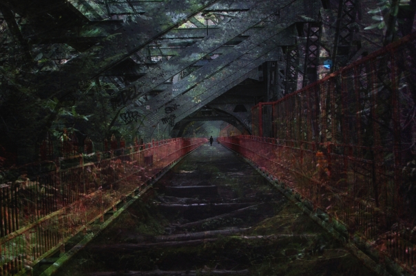
Williamsburg Bridge, Brooklyn
Mt. Mitchell, North Carolina
The following color pictures were taken with a Diana; the black and white ones with a Soviet Zorki-4


July, 2013, NYC –

An article called “10 Cities in the Western Hemisphere that Feel Cooler Than NYC Right Now” mentioned Death Valley… The week-long inferno peaked out at about 103 degrees, with matching humidity. Everyone has a glazed look in their eye, and walk stiffly to minimize any motion that does not involve keeping cool. The sort of heat that gives you chills – if this was the temperature of inside your body, you’d be laid in bed with fever, taking antibiotics

Engulfed by concrete and brick; a pizza oven.


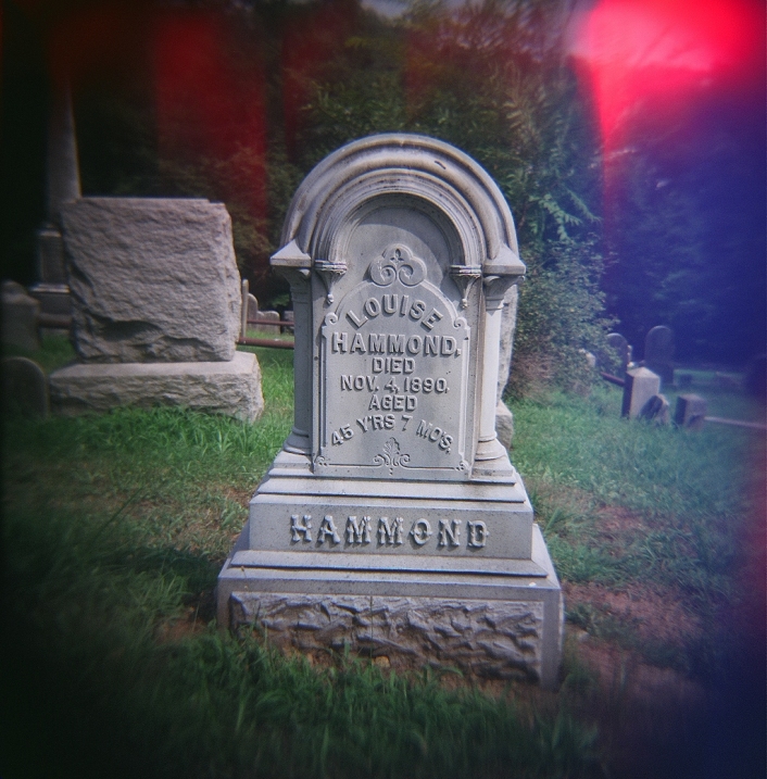
There’s no gentility here in the Salt Meadows. A backwater on Stuyvesant’s farm, disturbed only in those days by the creatures of the tidal wetlands. The summers here lay down a blanket of fiery, hanging, swampish air. Dazed dog-day weeks spawn the seediness that has always been essential here. Die Weisse Garten, 1850’s Sunday picnics of beer and comraderie, Sabbath carousal that disgusted the Nativists. Nativists, whose days were numbered by the coming tsunami of immigration that made this Kleindeutschland. The third largest German-speaking city on the globe. An exotic enclave in an overwhelmingly Anglo country.
“… There were still places in the city, such as Tompkins Square Park… where a passerby might overhear nothing but German…” (1895)
Their steps still plod along underneath, in silence. There is a lonely fountain, surrounded by the hyper voices of children in the playgrounds. There was that day more than 100 years ago that shattered this neighborhood. Fire on the River, 1000 gone. Just when they were beginning their summer.
In the 1980’s and early 90’s, the ever-encroaching grime gurgled up the swamp underneath, and generations of discontentment spewed forth police riots, encampments of men living in cardboard, junkies, squatters, crack heads, punks… When the tide turned, the city regained control of the park and reversed its decay- but never totally washed out the funk.
Fringes. They still sit huddled on the benches, their faces bent and darkened, in the corners where the old men play chess. Nearby there is a monument, erected in 1891, dedicated to Temperance, a deity that long ago became maligned in this wild square. 1840’s, 1870’s, 20th century – the radical center of a politically radical neighborhood. No number of old shady trees, grassy cosps, arranged flower beds, or dappled sun, has ever managed to moderate the mood here.
It’s not all disgust, fists in the air, overdoses on benches. The winter has long forgotten the old Germans it froze to death on Avenue B. Now the ice brings a serene crystallization, And the Spring, in turn, brings forth an orgy of excitement. It’s the sort of park where you try to immerse yourself in a book, and are unable. There is too much music and delight, too many beautiful passers-by. Central Park’s design tries to lead people into nature, Washington Square’s tries to lead people into lofty ideas and civic graces. Tompkins Square’s design, with its playgrounds and its dog run, and melange of people, tends to bring park-goers into vivid proximity to each other.
It was here, in the 1960’s, that the international hare krishna movement began under an ancient elm, perhaps planted in the days of the Germans. The age of Ginsberg’s livid “Howl”, when poets, musicians, and artists, like the punks of the ’80’s, exorcized their disgust of the world with exuberant wailing.
And so the mysterious forces of this buried salt marsh persist, the past dancing with the present, the seen mingling with the unseen. Never ending. All awaiting the death of time.


Williamsburg Bridge, Brooklyn
Mt. Mitchell, North Carolina
During the Gilded Age boom following the Civil War, the industrial revolution and the early days of mass production made it more affordable for women to maintain their households without having to spend as much time toiling at home. And so, some of the first modern department stores in the world began to open in the area between Union and Madison Squares. While their husbands were at work and their children at school, wives and mothers could enjoy the brief freedom of being out on the town independently. The area became known as “Ladies’ Mile”. A few stores from that era, like Lord and Taylor and Bergdorf Goodman, still operate in the city and beyond.

6th Avenue during the heyday of Ladies’ Mile
The subway was planned and constructed during this era, and as a modern, hurried commuter knows all too well, there are an unusual number of stops on the lines traveling through the former Ladies Mile.
The department store buildings that remain are beautifully designed, a few clad in cast-iron. The interiors of many, like the Home Depot on 23rd Street, have been modernized to accommodate modern commerce, and the area is still a major shopping destination.
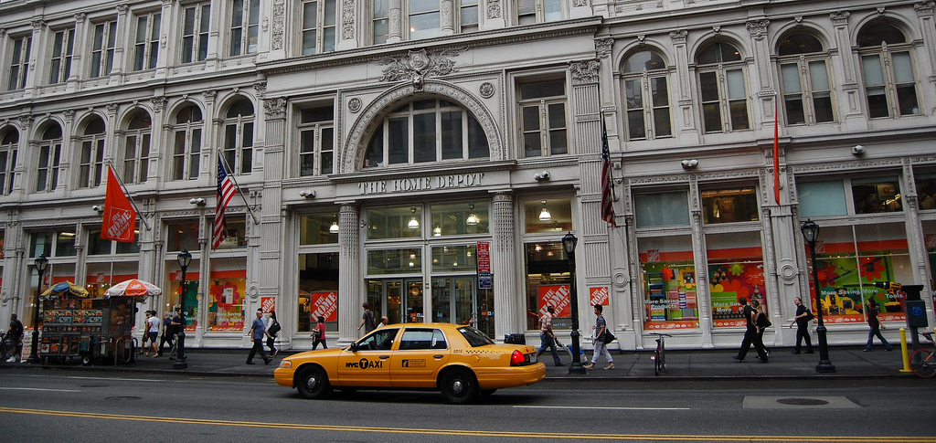
Stern Brothers – the largest department store of the 19th century, now converted into a Home Depot

Siegel-Cooper; now converted into a Filene’s Basement/ TJ Max/ Bed, Bath, and Beyond

In the early 1900’s. Siegel-Cooper surpassed Stern Bros. as the “largest store in the world”

Ehrich Brothers, now a Burlington Coat Factory and Staples

The O’Neill and Company department store opened in 1887, and was in business until 1907. Over the next century, the building served a number of purposes, and in 2006, at the height of real estate bubble, the gold domes were restored and the huge complex went residential. In late 2012, there was a minor structural collapse, which, I imagine, is still being resolved.

Hugh O’Neill and the 6th Avenue elevated train.

With the era of the department store came the beginnings of catalogue shopping

As New York entered the 20th century, highrises began to reshape the cityscape. The area between Union and Madison Squares is a treasure trove of beautifully designed buildings
Ultimately, the mass transit that had made Ladies’ Mile possible also allowed for development further uptown, and by World War I the neighborhood was in decline. But not before producing one of the world’s most iconic early skyscrapers –

Flatiron Building
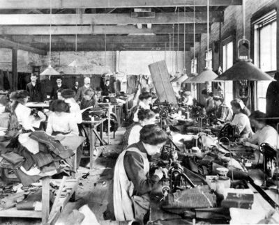
There was a darker side to the glory days of Ladies Mile. While middle- and upper- class women enjoyed a new public life, the poorer women of the city suffered in the sweatshops that supplied the products for sale
I have a great love for urban exploring – digging up obscure places and events in the annals of New York. Places like the Staten Island Ship Graveyard, Dead Horse Bay, the Mansion of King Zog, the 1964 World’s Fair Grounds, et al…
In many ways, the following topic is the most obscured. Barely anything physical remains of the Dutch colonial era- it exists now only in resonant names, culture, and perhaps, in ghosts that ply the dense streets of this city.

The tip of Manhattan Island, today’s Financial District, from the East River in the 1660’s. The World Trade Center is now roughly in the middle of the frame
Even though the Dutch Republic controlled New York for barely more than a generation, it left an indelible mark on the psyche of the city.
For centuries European nations sought control of the much coveted Northwest Passage, which was thought to allow a more direct sea route to Asia, allowing trade to bypass the arduous journey around Cape Horn or the Cape of Good Hope. When expeditions finally transited the route in the early 20th century, it had proven to be a pipe-dream – Arctic ice completely barred reasonable navigation until 2009, when the ice pack melted sufficiently to allow year-round passage.
The Dutch West India Company was founded as a conglomeration of merchants, explorers, and men of money to regulate and centralize colonial trade networks. As such, it became the de facto government of outposts throughout the world. It’s been said that the Company was akin to a modern global corporation – but with guns. Finding and controlling the Northwest Passage was at the top of the DWIC’s agenda. In 1609, they sent an English explorer, Henry Hudson, to scope out the North American continent and pursue any promising leads. After a long Atlantic voyage, Hudson came upon a very wide, protected bay, fed by a large river that penetrated deep into the interior – an obvious candidate for a Northwest Passage. Passing Manhattan island, Hudson made his way up his namesake river, as far as he could go. Disappointingly, it proved to be a dead-end. At least, however, he had found a source of a very valuable commodity at the time – beaver fur; a luxury item that could fetch high prices in Europe.

Former headquarters of the Dutch West India Company, in Amsterdam. It was from this building that the colony of New Amsterdam was chartered.
And so, over the following decades, Dutch settlers began arriving and trading. They covered a swath of remote outposts from what was known as the “South River” (The Delaware River) all the way past the “North River” (or the Hudson River, as it gradually became known). In the great harbor that Hudson had come upon, there were a handful of Europeans living on the very tip of Manhattan Island, and on “Noten Eylant” (now Governor’s Island). In 1624, the settlement, Nieuw-Amsterdam, was officially chartered as a colony of the Dutch Republic, and capital of the New Netherlands colonies. The Dutch, of course, were not alone in European designs of control of New World resources, and so very quickly, a fort was erected at what is now the Battery. Though plantations were scattered throughout the future five boroughs, and far beyond, the town was little more than Fort Amsterdam. One could walk from end to end in under 10 minutes, the distance between today’s Battery Park and Wall Street:

The extent of the New Amsterdam colony was roughly the distance between “A” and “B”
It was a reckless sort of person who would endure the dangers of the sea and then live on the very margins of civilization facing a highly uncertain future. It was a desperate sort of person that would go to such lengths to make a living or ensure a fortune in doing so. New Amsterdam became notoriously unruly. What’s more, it attracted settlers from all over the European world, including French Huguenots, Sephardic Jews, and of course, African slaves.
In addition, as was happening all along the Atlantic seaboard, the colonists made a poor first impression on the Indians. When one of the first directors of New Netherlands, Willem Kieft, demanded tribute from the local tribes, skirmishes broke out which led to a short, ugly war that still bears his name.
In response to Kieft’s lack of control, in 1647 the Dutch West India Company replaced him with Petrus (Peter) Stuyvesant, a veteran of conflicts in the Caribbean. With ambitious zeal, he razed houses at Fort Orange (Albany, NY) and drove out the Swedes from the banks of the Delaware River and founded the city of New Castle. It was Stuyvesant who dug the Heere Gracht, the canal that was later filled in and called Broad Street. And on the edge of town, he built the defenses that gave Wall Street its name.

The 1660 “Castello Plan” of New Amsterdam, which encompasses the area between “A” and “B” on the Google map above. Note the Wall and the canal that became Broad Street. Broadway is the wide thoroughfare extending from the fort. Once can also see Peter Stuyvesant’s “White Hall”, which gave its name to Whitehall Street

Former location of the Dutch canal, which was renamed Broad Street, after the polluted waterway was filled in.
The NY Stock Exchange is visible on the left.
He imposed a string of austere policies meant to whip the colony into shape. Crimes were more harshly punished, taverns were ordered closed on Sundays, and church attendance became mandatory. He certainly kept order, but was wholly unpopular. Some of his more extreme enforcements were met with strong retorts. When a ship of Sephardic Jews arrived from Brazil, he tried to turn them away until pressured by the Dutch West India Company to desist. When he tried to brutally suppress Quakerism in the village of Vlissingen (Flushing, Queens), he was met with the “Flushing Remonstrance”, a resistance that inspired the freedom of religion clause in the Bill of Rights.

The house of John Bowne, a noted Quaker, who left repression in New England for the Dutch colony of Vlissingen (Flushing). He was arrested by Peter Stuyvesant for having a Quaker meeting in this house in 1662. Outcry over the arrest led to the “Flushing Remonstrance” It is the second oldest structure in New York City,
With the English to the north and to the south, New Netherland was caught in the pincers, and England was eager to take over the entirety of the Atlantic coast. In late summer of 1664, their navy appeared in the harbor of New Amsterdam and demanded surrender. Stuyvesant made a call to arms, which fell on cold shoulders. The English offered free passage back to Europe for those who would not submit to their rule; but hardly anyone took them up on it. It has been said that the colonists didn’t care what nation ruled them, as long as they could make money.
And so, the colony went back to its business, now under the name of New York. Dutch custom, culture, and language persisted for generations before dwindling away. In fact, there were still native Dutch speakers at the time of the American Revolution more than a century later.
A few Dutch-era names rose to lasting prominence, and were counted among old patrician families that author Washington Irving called the “Knickerbockers”. Some of them are still very current – the Roosevelts and the Vanderbilts, for instance.

The backyard of St. Marks Church-in-the-Bowery, built in 1799 on the site of the family chapel of Stuyvesant’s 62-acre Bouwerij estate, now the heart of the gritty East Village. His remains are buried within.
The church sits askew of the Manhattan grid, recalling the country path that once passed by.
Stuyvesant lived out the final eight years of his life at his Bouwerij (plantation) in the fields outside the city. He is interred at St. Marks Church-in-the-Bowery, built in 1799 on the site of his family chapel. In 1867, one of his pear trees, now surrounded by the city at 13th Street and 3rd Avenue, succumbed to a horse cart accident. It was the final living remnant of New York’s Dutch origins.

The last tree of Stuyvesant’s estate, and the last living connection to New Amsterdam, at 13th Street and 3rd Avenue in the 1860’s, soon before it died. Note the large protective fence.
And so today, apart from some tavern and town hall foundations recently excavated around Hanover Square (you can view them from a window in the sidewalk), the vestiges of the city’s Dutch era exist only in names and spirit. New York lived up to New Amsterdam’s mercantile ambitions, and then some. For better or worse, it is still a place where money talks, regardless of your origins or beliefs.
And the names – those who live in the region hear them every day – names like Haarlem, Breukelen, Conyne Eylandt (named for its rabbits), Tappan Zee, Hell Gate, New Utrecht, Flushing, Van Wyck Expressway, and the “Kills” (creeks) that appear in town and river names up and down the Hudson Valley…
Stuyvesant’s Bouwerij became the notoriously scruffy Bowery, and the raucous East Village now covers his plantation. The diagonal country lane passing in front of his church, now named Stuyvesant Street, is a solitary hold-out against the 1811 Manhattan grid plan. His name is still everywhere – high schools, housing developments, libraries, etc.
250 years after New Amsterdam, the coarsely planned colonial streets gave birth to the skyscraper and to the world’s financial capital. The narrow lanes, meant for small houses, now host some of the tallest buildings in the world, which have obscured the ground perpetually in shadow. On quiet blocks, or at night, squeezed between the concrete canyons, you can almost hear the clogged feet on packed earth, the cantor of a passing horse, or the whispers in Dutch. All historical facts aside, this is where one can feel closest to the distant outpost on the edge of the world that once was.

Amazingly, the streets of New Amsterdam were never widened to accept 20th century skyscraper construction.
Appropriately, in the end, one of my most striking New York moments was not here, but in old Amsterdam, in the train station, when I heard a departure announcement for Breukelen. Full circle around the elusive story of Dutch New York.

The Gowanus Canal, Brooklyn. Once called the Gowanus Creek, a number of Dutch mills lined its shore. Today, it is one of the most polluted waterways in the country

The 17th century “Dutch House” in New Castle, Delaware, which was founded by Peter Stuyvesant.
A few Christmas’s back, I loaded my Diana with Ilford Hp5 medium format film, and shot a series inspired by one of my favorite Christmas “anti-carols”, the Pogue’s “Fairytale of New York”.

“i can see a better time”

“you took my dreams from me”

“i’ve got a feeling this year’s for me and you”

“and then he sang a song”

“queen of New York City”

“i dreamed about you”

“the boys of the NYPD choir were singing Galway Bay”

“well so could anyone”

“you promised me Broadway was waiting for me”

“i built my dreams around you”

In two days, on December 13, it will be St. Lucia’s Day- the patron saint of light, which I mentioned in a post from about this time last year.
As the Northern Hemisphere plunges into its darkest time of year, I’m once again thinking lightward, but this time in visions of this past summer:
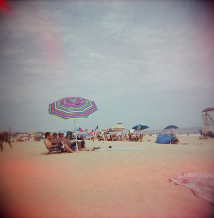
Montauk, Long Island
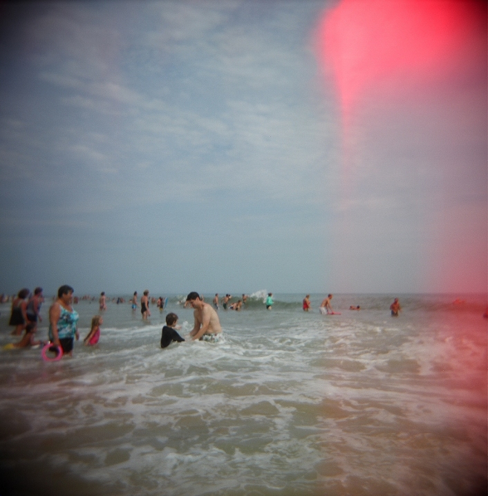
Montauk, Long Island
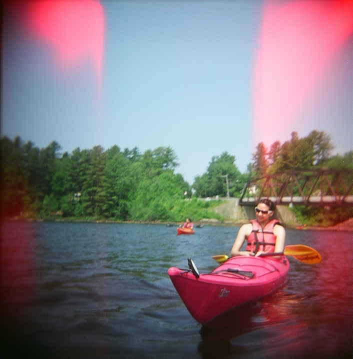
Long Lake, NY
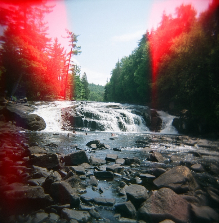
Buttermilk Falls, NY
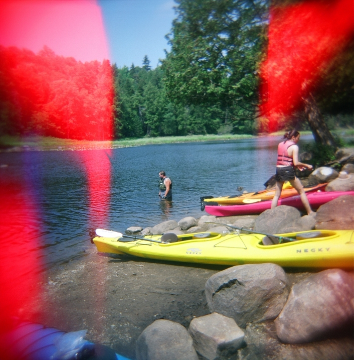
Raquette River, NY
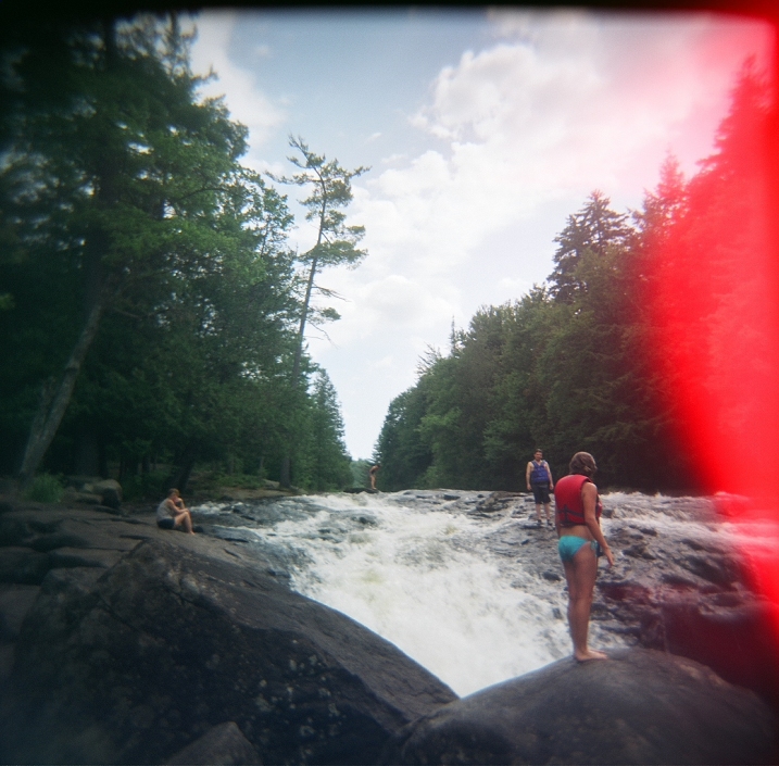
Buttermilk Falls, NY
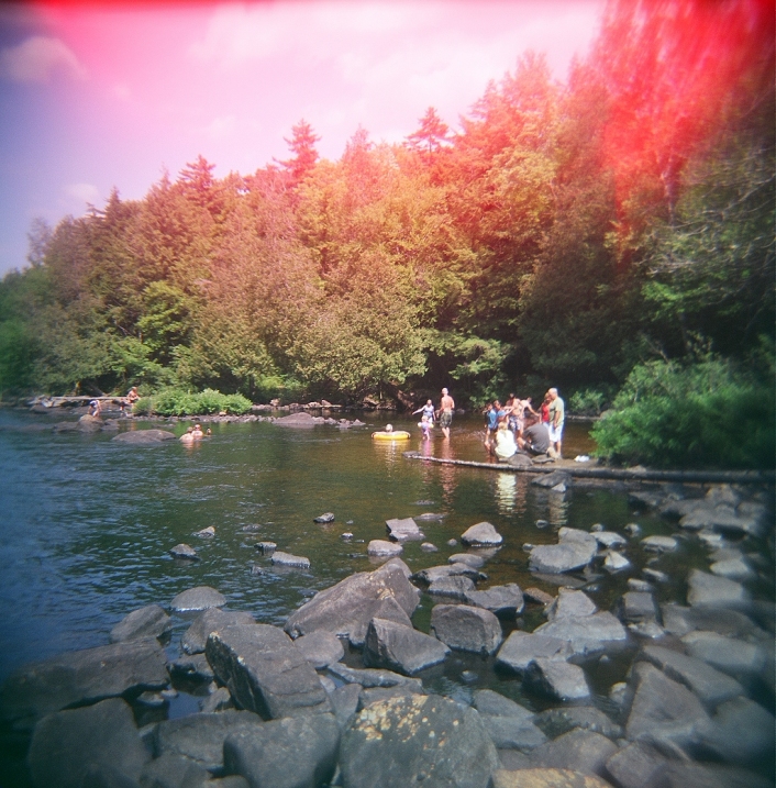
Raquette River, NY
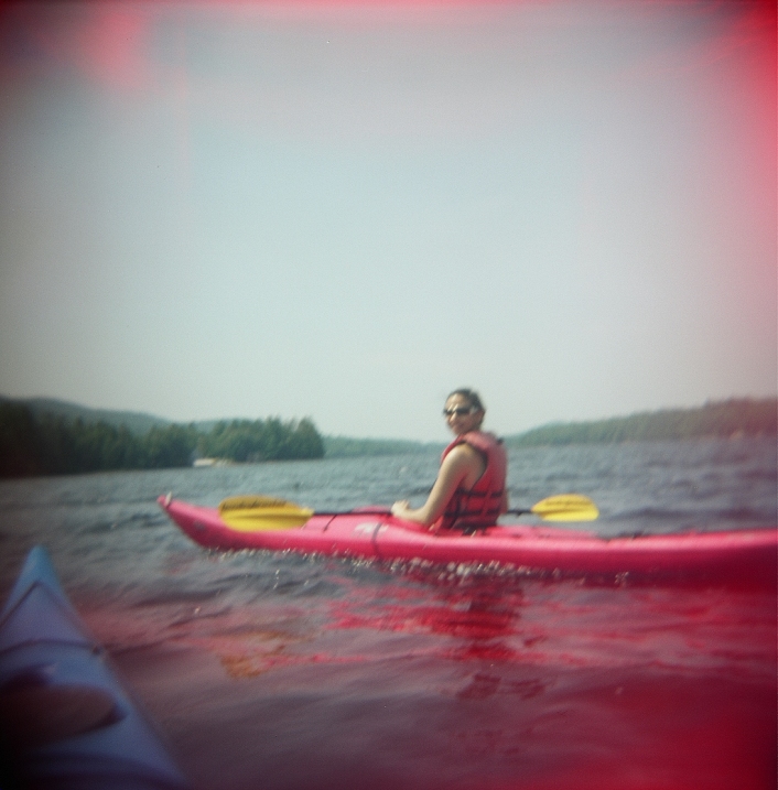
Long Lake, NY

Tarrytown, NY
Tarrytown, NY
These were taken throughout the Adirondacks and Hudson Valley of New York during the summer of 2012 – Velvia 100 (water-damaged) in a Holga.
Here are a couple of related posts:
https://ventilateblog.wordpress.com/2011/07/31/241/
On Friday, I compiled my running string of Facebook and Twitter posts dealing with “Superstorm” Sandy. Today, with relief and recovery efforts underway, and as another nor’easter bears down on the NY – NJ metropolitan region, I once again present a compilation of my hour-to-hour posts.
Some photosets of post-storm NYC:
Scenes from a blacked out Manhattan: http://www.flickr.com/photos/mattron/sets/72157631914010512/
Scenes from the Rockaways: http://www.flickr.com/photos/mattron/sets/72157631950208338/

Rockaway Beach Blvd.
As nightime temperatures approach freezing, millions are still without power, and many communities are completely displaced. People are no less in dire straits than they were when the storm hit. Here are a few resources for those who need help, and those who can offer help:
http://www.newyorkcares.org/
http://www.artfagcity.com/2012/11/01/how-to-volunteer-for-hurricane-sandy-clean-up/
http://www.nyc.gov/html/nycservice/home.html
http://abcnews.go.com/US/hurricane-sandy-victims/story?id=17598687#.UJP0WXYy2kA
A site specific to the Rockaways – a resource for volunteers and those needing help: http://rockawayhelp.com
By all accounts I’ve heard and seen first hand, OccupySandy has been doing an excellent job getting into areas and helping in ways that conventional relief agencies have been unable to:
Check out the site if you need help, or can provide it: http://interoccupy.net/occupysandy/
An NYC.gov apartment sharing resource. Be a host, or a guest! https://www.airbnb.com/sandy
– A tremendously comprehensive crisis map from Google. Even a week after the storm, things are changing hour to hour, so always double check!: http://google.org/crisismap/2012-sandy
Text SHELTER + zip code to 43362 (4FEMA) to receive information on the nearest shelter in your area
Friday, November 2, 2012 –
Yesterday I took some photos from within the “blackout zone” of Manhattan, the immense stretch from 34th Street to the Battery:

Looking down Broadway – post Sandy blackout
The full photoset: http://www.flickr.com/photos/mattron/sets/72157631914010512/
– Lights are coming back on in Manhattan, and the marathon has been cancelled. You can probably hear the cheering from space. It’s just in time too. Manhattan is dealing really well, but I can’t see it taking the lack of access to food and water for too much longer.
– In the city alone, more than 200 lost pets need foster homes: gothamist.com/2012/11/02/urgent_adopt_or_foster_these_dogs_a.php
– An incredible shot of a darkened Chinatown:

– So power’s coming back rather quickly to Manhattan – Considering the nightlife “meccas” that were hit, whatever bar manages to open is surely going to see a rager tonight.
It was before I was born, but many recall that during the blackout of 1977, which didn’t last nearly as long, the city saw terrible rioting and looting. I can’t say enough about all the comraderie and generosity I’ve seen; people really did become reacquainted with their immediate neighbors. You see it often on the news happening in other parts, but it’s really striking to see the Nat’l Guard handing out MRE’s in NYCNow that things are looking up for Manhattan, hopefully more attention can be focused on the really devastated areas in the Rockaways, the Brooklyn oceanfront, and, of course, the Jersey Shore and Staten Island. It’s a neighborhood most people don’t know, but it’s coming out that Gerritsen Beach in Brooklyn, which was not officially in the Zone A evacuation area, saw tidal surge upwards of 8 feet. Another shattered neighborhood among many.On a brighter side, many would-be marathon participants are offering help and their hotel rooms to the displaced. Also, the NY Aquarium, which was completely flooded, seems to be on the path of recovery, with most of the animals unharmed.

in the Rockaways
Jersey City and Bayonne are back on the grid, may be another week for the Rockaways. Floyd Bennett Field is a staging ground. People are waitng on line for more than 4 hours for gas – one stretches for two miles. Some counties are enacting rationing – (even days for plates that end in an even number)
They’re still looking survivors all along the shore. Many have lost everything. Devastation and terrible stories from Connecticut down to New Jersey – The world’s 4th largest metropolitan area and then some.


The Rockaways


